The following transition memo provides incoming decision makers with an overview of Iñuuniałiqput Iḷiḷugu Nunaŋŋuanun (Documenting Our Way of Life Through Maps – Northwest Arctic Borough Subsistence Mapping Project). The memo addresses four topics including project background; methods; outcomes; and recommendations.
PROJECT BACKGROUND
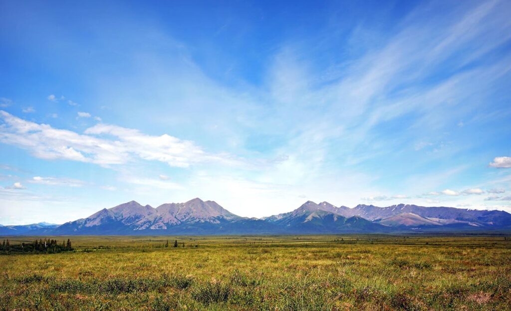
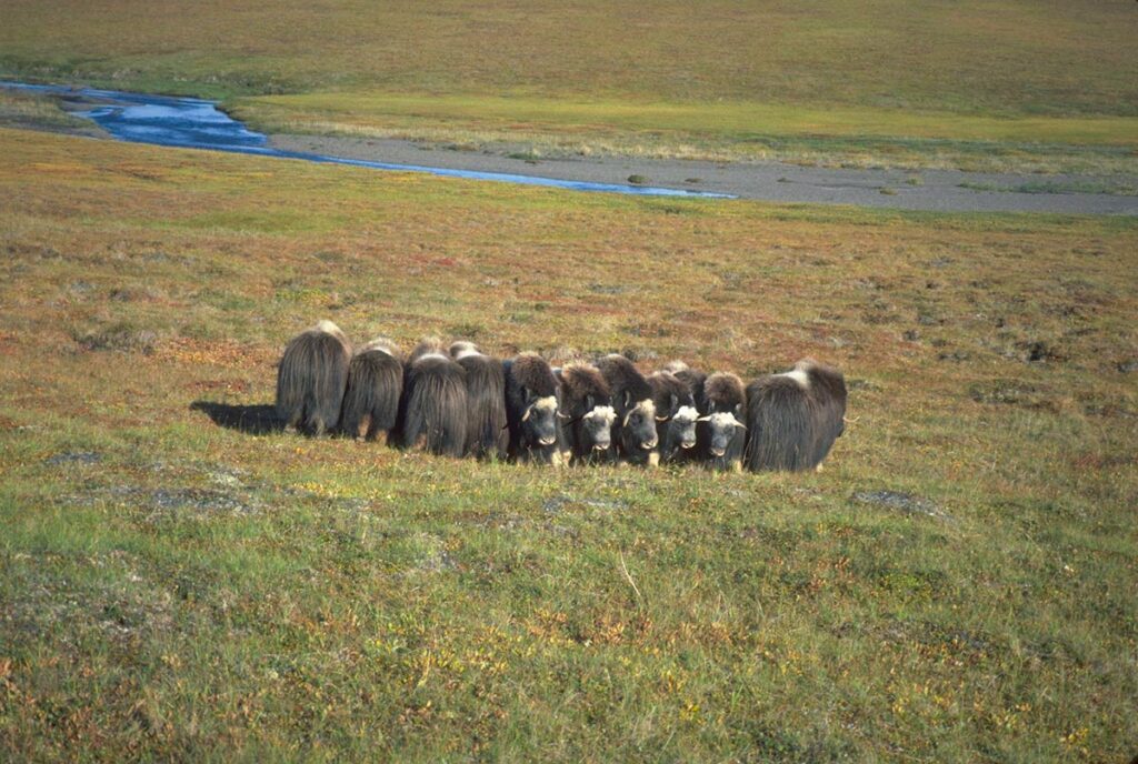
The Northwest Arctic Borough Subsistence Mapping Project documents local traditional knowledge and scientific information depicting subsistence use (where people hunt, fish, and gather by season) and important ecological areas (where animals feed, breed, raise young, and migrate by season) surrounding the communities of Kivalina, Noatak, Selawik, Noorvik, Deering, Buckland, and Kotzebue. The purpose of the project was to produce updated and scientifically defensible maps showing subsistence use and important ecological areas surrounding the Borough’s coastal communities for use in land use planning and commenting on federal plans, including but not limited to, offshore oil exploration and oil spill response. The project was conducted in fulfillment of Northwest Arctic Borough Assembly Resolution 11-04 to improve subsistence information to aid in permitting, zoning, and land use decision-making; and in support of Title 9 of the Borough code, specifically Chapter 9.28, which recognizes the importance of protecting subsistence resources critical to the quality of life of all residents in the Borough. The project was made possible with the support of many Borough residents; tribes; cities; staff; consults; and decision makers; and with funding provided by the Coastal Impact Assistance Program (CIAP), the Oak Foundation, ConocoPhillips, and Royal Dutch Shell.
METHODS
The people of the Northwest Arctic Borough drove the subsistence mapping project. Protocols were developed to protect local traditional knowledge. Project methods combined local traditional knowledge and formal science to map subsistence use and important ecological areas. The project methods are briefly summarized below and include compiling existing scientific information on subsistence; protecting local traditional knowledge; documenting local traditional knowledge; checking results using local traditional knowledge; checking results using formal science; mapping existing permits and publicly known resource development areas; mapping results to support planning and comments on federal plans; and submitting project methods for independent scientific review as summarized below.
Compiled Existing Scientific Information on Subsistence – Collected the latest existing scientific information on subsistence in Northwest Alaska. A review of the scientific information was conducted to identify missing topics and provide recommendations for future research. Information that could be mapped was included in the project.
Protected Local Traditional Knowledge – Developed an informed consent document to notify voluntary interviewees about how project information would be used; by whom; for what purpose; how individuals would be compensated for their involvement; and describe who funds the project. Information collected during the interviews is confidential. Mapped information is aggregated, or grouped, so the activity of an individual cannot be seen. This technique is called heat mapping, where a darker color on a map shows a higher intensity of subsistence use. This technique has been used successfully by the Northwest Arctic Borough for land use planning at Red Dog while not creating “treasure maps” that accidentally show sensitive information. The maps were checked in each participating community. After conducting the Iñuuniałiqput Iḷiḷugu Nunaŋŋuanun (Documenting Our Way of Life Through Maps) Page 3 of 4 interviews, each person was asked for permission to use their information in the atlas. Of the 231 people interviewed, 95% provided written permission to use their information in the atlas. Those who did not provide written permission to use their information were removed from the atlas.
Documented Local Traditional Knowledge – Methods for conducting interviews to collect local traditional knowledge of subsistence use and important ecological areas were developed. The methods were checked by an independent scientific panel. Edits were made to the methods, as needed, to ensure the scientific defensibility of the project. A list of interviewees was produced with guidance from village- based staff and support from the tribal councils, cites, and NANA Resource Offices who identified high harvesters and the most knowledgeable hunters, fishers, and gatherers in each community. Conducted 231 individual interviews to map subsistence use and important ecological areas surrounding the seven participating communities.
Checked Results Using Local Traditional Knowledge – Conducted 32 meetings in seven communities to provide expert local review of maps produced in the project. The maps were reviewed by more than 49 locally appointed advisors, recommended and approved by the participating tribal councils and cities, for their knowledge of hunting, fishing, gathering, and the Iñupiaq language. Edits and additions to the maps recommended by the advisors were made as needed.
Checked Results Using Formal Science – Conducted a statistical and spatial analysis to ensure sufficient local traditional knowledge information had been collected to provide a representative and complete depiction of subsistence use for the seven participating communities.
Mapped Existing Permits and Publicly Known Resource Development Areas – Identified potential resource development areas through a review of exiting Northwest Arctic Borough permits and publicly known resource development areas in the region.
Mapped Results to Support Planning and Comments on Federal Plans – Produced a searchable database in geographic information system (GIS) format reflecting information gathered during interviews with hunters, fishers, and gatherers in Kivalina, Noatak, Selawik, Noorvik, Deering, Buckland, and Kotzebue.
Submitted Project Methods for Independent Scientific Review – Supported the production of a scientific publication addressing the methods used in the project to ensure the representativeness and completeness of the local traditional data collected.
OUTCOMES
Accomplished all grant terms and related deliverables. The outcomes of the project are summarized below and include the Northwest Alaska Subsistence Literature Collection; Northwest Alaska Subsistence Literature Review; Selawik Comprehensive Subsistence Harvest Survey; Subsistence Youth Activities; Iñupiaq Place Name Mapping; Subsistence Atlas; Subsistence Web Portal; Subsistence Youth Essay Contest; Subsistence Photo Contest; and Community Outreach.
Developed a Northwest Alaska Subsistence Literature Collection – Funded the Alaska Department of Fish and Game Division of Subsistence to produce a Northwest Alaska Subsistence Literature Collection. The purpose of the collection is to provide decision makers with the latest scientific information on subsistence issues in the region. The literature collection includes all the technical papers published by the Alaska Department of Fish and Game Division of Subsistence and by the Minerals Management Service Alaska Outer Continental Shelf Region (MMS Alaska OCS Region) program (now the Bureau of Ocean Energy Management). The literature collection includes approximately 1,500 journal articles, conference Iñuuniałiqput Iḷiḷugu Nunaŋŋuanun (Documenting Our Way of Life Through Maps) Page 3 of 4 papers, books, and reports related to subsistence in Northwest Alaska that ADF&G collected in the course of their research. Some noteworthy topics contained in the subsistence literature collection include:
- Northwest Alaska subsistence activities, such Georgette and Shiedt (2005) Whitefish: Traditional ecological knowledge and subsistence fishing in the Kotzebue Sound Region, Alaska.
- Northwest Alaska subsistence species, including some reports from other areas that cover species found locally, such as Underwood (2000) Abundance, length composition, and migration of spawning inconnu in the Selawik River, Alaska.
- Archeological and historical subjects such as Anderson (1988) Onion Portage: The archaeology of a stratified site from the Kobuk River, Northwestern Alaska.
- Economic topics, such as Kruse (1991) Alaska Inupiat subsistence and wage employment patterns: understanding individual choice.
- Food safety topics, such as Kuhnlein and Chan (2000) Environment and contaminants in traditional food systems of northern indigenous peoples.
- Food security topics, such as Ford (2009) Vulnerability of Iñuit food systems to food insecurity as a consequence of climate change: a case study from Igloolik, Nunavut.
- Theoretical literature from ecology, economics, sociology, and other disciplines that may (or may not) be relevant to subsistence in northwest Alaska such as Axelrod (1984) The Evolution of Cooperation, Henrich (2004) Foundations of human sociality: Economic experiments and ethnographic evidence from fifteen small-scale societies, Ostrom (2009) A General Framework for Analyzing Sustainability of Social-Ecological Systems, and Sahlins (1972) Stone age economics.
A bibliography, listing each publication and including a short summary, is available at the Borough.
Developed a Northwest Alaska Subsistence Literature Review – Funded the Alaska Department of Fish and Game Division of Subsistence to produce a literature relevant to subsistence hunting, fishing, and gathering in Northwest Alaska.
Conducted a Selawik Comprehensive Subsistence Harvest Survey – Funded the Alaska Department of Fish and Game Division of Subsistence to produce comprehensive subsistence harvest survey in Selawik. The report is available free of charge (http://www.adfg.alaska.gov/techpap/TP389.pdf).
Conducted Subsistence Youth Activities – During the Northwest Arctic Borough Subsistence Mapping Project’s work in the Borough’s coastal communities, elders expressed the desire to have youth involved in the subsistence mapping project. Many expressed concern that fewer youth are going out to hunt, fish, and gather. The observations shared elders were supported by information gathered by the project team, showing that fewer younger people are going hunting, fishing, and gathering. The purpose of the subsistence youth activities was to share local traditional knowledge of hunting, fishing, and gathering with youth and teach students how to pass these skills on to the next generation. The Borough required each activity include a lesson plan and budget. In 2015 the Borough sponsored 25 youth activities.
Mapped Iñupiaq Place Names – Elders emphasized the importance of mapping traditional Iñupiaq place names to support endangered language preservation and improved emergency response as the Northwest Arctic Borough Subsistence Mapping Project team met with advisory groups in the seven participating communities. With support from NANA, Aqqaluk Trust, the Regional Elders Council, and the National Park Service, the Northwest Arctic Borough and mapped 2,000 traditional Iñupiaq place names to promote youth education through endangered language preservation and improved emergency response. Many of the original maps were missing or damaged. The Northwest Arctic Borough located the original data and mapped this information in GIS format. Elders noted some of the names documented nearly 30 years ago were in the wrong location or spelled incorrectly and emphasized the need to check the spelling Iñuuniałiqput Iḷiḷugu Nunaŋŋuanun (Documenting Our Way of Life Through Maps) Page 3 of 4 and location of the place names. The Northwest Arctic Borough Subsistence Mapping Project and NANA met with elders fluent in the Iñupiaq language and checked the spelling and location of the place names.
Developed a Subsistence Atlas – Produced a 650-page book with 400 maps documenting local traditional knowledge and the latest scientific information depicting subsistence-use areas by season and important ecological areas by season surrounding the seven participating communities. The draft atlas has been shared with participating tribal councils, cities, and the Northwest Arctic Borough Assembly.
Developed a Subsistence Web Portal – Developed an interactive web portal to support land use planning and emergency response.
Conducted a Subsistence Youth Essay Contest – Conducted a subsistence youth essay contest. The purpose was to show the importance of the subsistence way of life by giving students an opportunity to share what they learned during the subsistence youth activities and promote youth leadership through participation in government. Of 21 essays received, seven were selected as winners. Six youth conducted community service projects. Seven youth traveled to Washington, DC for legislative advocacy training and meetings with senior officials at the Department of the Interior, Congress, and the White House.
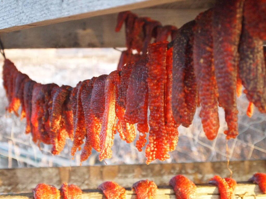
Conducted a Subsistence Photo Contest – Conducted a subsistence photo contest to gather local images depicting the harvesting and preparation of traditional subsistence foods. More than 1,000 people participated in the subsistence photo contest. The highest quality images are featured in the atlas.
Community Outreach – Shared regular project updates with tribes, cities, industry and agencies using KOTZ Radio; quarterly written reports; regular presentations to the Northwest Arctic Borough Planning Commission and the Northwest Arctic Borough Assembly; presentations at 3 annual workshops in Kotzebue; presentations at 5 conferences; development of a newsletter; and support for the production of a film addressing the impacts of changing weather and climate on subsistence users in Northwest Alaska. The project was also featured in 17 sources.
Review, Print, and Distribute the atlas – The project includes the production of a printed atlas, with support from two consultants including Liz Dodd dba IDTC who provided writing and editing services and Strategies 360, Inc. who provided graphic design related services. The atlas is longer than originally anticipated, approximately 650 pages in length with 400 pages of maps. The atlas has been reviewed by participating tribes, cities, and the Northwest Arctic Borough Assembly. Funding is available to cover this cost through a donation provided by ConocoPhillips.
Review and Feature Web Portal – A web portal has been developed to support land use planning and emergency response. The web portal is near completion. The Planning Director recommended review of the draft web portal by the Lands Committee prior to circulation.